


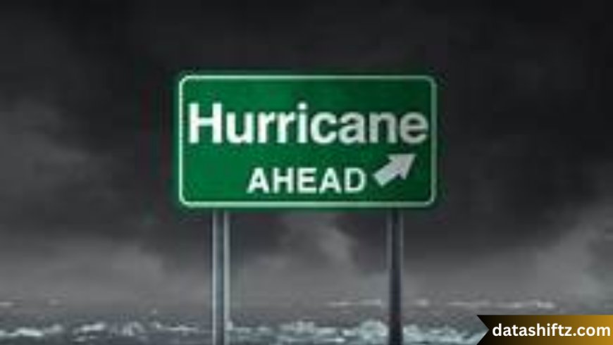
Hurricane Tracker: Staying Ahead of Nature’s Fury
Introduction
Hurricanes are among the most powerful and destructive weather phenomena on Earth. Their immense winds, torrential rains, and storm surges can wreak havoc on communities, causing loss of life and billions of dollars in damage. In today’s world, hurricane trackers have become indispensable tools for meteorologists, emergency managers, and the public alike. These trackers provide real-time updates on storm development, intensity, trajectory, and potential impact zones, enabling better preparedness and timely evacuations.
This article dives deep into the world of hurricane tracking—explaining how trackers work, the technologies behind them, the types of information they provide, and how individuals and communities can leverage these tools to stay safe and informed.
How Hurricane Trackers Work
The Science Behind Tracking Hurricanes
Hurricane trackers utilize a combination of satellite imagery, radar data, weather balloons, aircraft reconnaissance, and computer models to monitor tropical storms and hurricanes. Satellites orbiting Earth provide visual and infrared images, helping meteorologists identify storm formation, eye development, and cloud patterns.
Reconnaissance aircraft, often called "Hurricane Hunters," fly directly into storms to measure wind speeds, pressure, humidity, and temperature, feeding accurate data into forecasting models.
Computer models simulate hurricane paths based on atmospheric pressure, sea surface temperatures, wind shear, and other meteorological variables. These models run on supercomputers and are continuously updated as new data arrives.
Key Components of a Hurricane Tracker
| Component | Description | Role in Tracking |
|---|---|---|
| Satellites | Provide real-time images and data on cloud cover, temperature, and storm structure | Detect formation, monitor movement and intensity |
| Radar Systems | Ground-based radars measure rainfall intensity and storm rotation within proximity to land | Track storm approach and rainfall estimates |
| Hurricane Hunters | Aircraft that penetrate storms to gather direct measurements | Provide detailed wind, pressure, and humidity data |
| Computer Models | Numerical simulations predicting storm track, intensity, and potential impacts | Forecast future path and strength |
| Buoys and Weather Stations | Sensors in ocean and coastal areas monitor sea surface temperature and atmospheric conditions | Support data for models and early warning systems |
Types of Hurricane Trackers
Online and Mobile Trackers
In the digital age, hurricane trackers are easily accessible to the general public through websites and mobile apps. Popular platforms include the National Hurricane Center (NHC), Weather.com, and private weather services. These trackers offer interactive maps, detailed storm data, and real-time alerts.
Government and Meteorological Agencies
National agencies like the U.S. National Hurricane Center, the National Oceanic and Atmospheric Administration (NOAA), and regional centers worldwide provide official hurricane tracking. They utilize the most advanced technology and issue warnings to protect life and property.
Social Media and Community Trackers
Social media platforms and community-driven websites offer hyperlocal tracking and updates. While these can be valuable, users should verify information from official sources to avoid misinformation.
How to Use a Hurricane Tracker Effectively
Understanding Track Maps
Hurricane track maps show the current position of a storm and its projected path. These maps usually include:
-
Cone of Uncertainty: An area where the storm center is likely to travel, accounting for forecast errors.
-
Wind Radii: Zones around the storm center with specific wind speeds.
-
Watch and Warning Areas: Regions advised to prepare or evacuate.
Monitoring Intensity and Changes
Storm categories (1 to 5) based on wind speed indicate potential damage. Trackers often provide current intensity and forecasts of strengthening or weakening.
Preparing Based on Tracker Information
Use hurricane trackers to:
-
Identify if you are in an evacuation zone.
-
Time your preparations to avoid last-minute rushes.
-
Follow official warnings and guidance closely.
Advantages of Using Hurricane Trackers
-
Real-Time Updates: Receive immediate notifications about storm developments.
-
Accurate Forecasts: Leverage sophisticated models to understand storm behavior.
-
Safety: Plan evacuation and safety measures proactively.
-
Resource Allocation: Governments and emergency services can better allocate resources.
-
Community Awareness: Enhance community preparedness and response.
Limitations and Challenges
-
Forecast Uncertainty: Despite advances, predicting exact paths remains challenging.
-
Technology Access: Not everyone may have access to online trackers.
-
Misinformation: Non-official sources may spread inaccurate updates.
Essential Tips for Hurricane Preparedness Using Trackers
-
Regularly check official hurricane trackers during hurricane season.
-
Sign up for alerts on your mobile device.
-
Prepare your emergency kit early based on storm forecasts.
-
Know your evacuation routes before the storm arrives.
-
Keep communication devices charged and backed up.
Hurricane Tracker Tools Comparison Table
| Tracker | Platform | Key Features | Ideal For |
|---|---|---|---|
| National Hurricane Center | Website, Mobile | Official updates, cone of uncertainty, maps | General public, emergency planners |
| Weather.com Hurricane Tracker | Website, App | Interactive maps, radar overlays, forecasts | Casual users, weather enthusiasts |
| Hurricane Tracker Apps | Mobile (iOS, Android) | Push alerts, storm tracking, preparedness tips | Individuals on-the-go |
| NOAA Weather Radar | Website, App | Real-time radar data, severe weather alerts | Professionals, meteorologists |
| Community Weather Networks | Social media, websites | Localized updates, storm photos/videos | Local residents, community groups |
Conclusion
Hurricane trackers are vital tools that empower individuals and communities to face the threats of tropical storms head-on. With the combination of advanced technology, official data, and user-friendly platforms, staying informed and prepared has never been easier.
As hurricane seasons grow more intense due to climate change, understanding and utilizing these trackers is essential. Remember, while technology aids in forecasting, personal responsibility and timely action ultimately save lives.