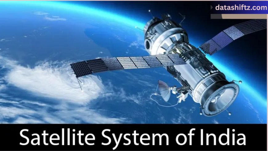
Satellite Images: A Window into the World from Space

Introduction
In the digital age, satellite images have become more than just spectacular views of Earth from above—they’re vital tools for science, defense, agriculture, disaster management, journalism, and everyday life. These images, captured by Earth-observing satellites orbiting hundreds to thousands of kilometers above our planet, provide a unique and powerful perspective of natural and human-made phenomena.
From tracking hurricanes in real-time to analyzing crop health or monitoring deforestation in the Amazon, satellite imagery has transformed how we observe, interpret, and respond to events on Earth. As technology advances, the quality, resolution, and applications of satellite images continue to expand dramatically, offering an unprecedented view of both global and local changes.
In this article, we delve deep into what satellite images are, how they work, their major uses, and why they are more essential now than ever before.
What Are Satellite Images?
Understanding the Basics
Satellite images, also called satellite photographs or Earth observation images, are pictures of Earth or other planets taken by imaging satellites operated by governments and private organizations. These satellites use various sensors to capture data across different parts of the electromagnetic spectrum, such as visible light, infrared, and radar.
Satellite imagery can be:
-
Optical: Captures light in the visible spectrum, like a digital camera.
-
Infrared: Detects heat and thermal emissions.
-
Radar: Uses radio waves to detect elevation, surface textures, and movement, even through clouds.
Types of Satellite Imagery
| Type | Description | Applications |
|---|---|---|
| Visible | Similar to what the human eye sees | Weather reports, news, urban mapping |
| Infrared | Captures heat emissions | Forest fire monitoring, crop health |
| Thermal | Detects temperature changes | Industrial monitoring, water analysis |
| Radar (SAR) | Penetrates clouds and works at night | Disaster mapping, military surveillance |
| Multispectral | Captures data from multiple bands (visible + infrared) | Environmental and agricultural analysis |
Major Uses and Applications of Satellite Images
A Global Tool Across Industries
Satellite images are used extensively across sectors—from scientific research to commercial development. They offer real-time insights and historical comparisons, aiding decision-making in fields that rely on spatial and environmental data.
Top Applications of Satellite Images
-
Weather Forecasting
-
Real-time tracking of storms, hurricanes, and temperature shifts.
-
-
Disaster Management
-
Assessing damage from floods, wildfires, earthquakes, and tsunamis.
-
-
Agriculture Monitoring
-
Crop condition assessment, drought prediction, and irrigation planning.
-
-
Urban Planning & Infrastructure
-
Mapping city growth, traffic patterns, and land use changes.
-
-
Environmental Conservation
-
Tracking deforestation, glacier melt, water quality, and pollution.
-
-
Military and Intelligence
-
Surveillance, mapping strategic locations, and conflict zone analysis.
-
-
Journalism and Investigations
-
Uncovering human rights abuses, refugee movements, or construction activities.
-
-
Navigation and GIS
-
Integration with GPS systems for mapping and autonomous vehicle routing.
-
Satellite Image Usage by Industry
| Industry | Use Case Example | Satellite Type |
|---|---|---|
| Agriculture | Monitoring NDVI (plant health index) | Multispectral |
| Meteorology | Forecasting hurricane movement | Infrared/Visible |
| Defense & Intelligence | Tracking troop movements | Radar & Optical |
| Environmental Science | Monitoring Arctic ice changes | Thermal/Infrared |
| Journalism | Investigating illegal mining or deforestation | High-resolution Optical |
| Disaster Relief | Rapid assessment after earthquakes or floods | Radar & Optical |
Advancements in Satellite Imaging Technology
From Low-Res to Ultra-HD: A Technological Leap
The evolution of satellite imaging over the past few decades has been extraordinary. Early satellites offered low-resolution black-and-white images, but today's systems can capture sub-meter detail, identifying objects as small as a car or even a person.
Some of the key breakthroughs include:
-
High-resolution commercial satellites (like Maxar’s WorldView-3 or Planet Labs' SkySat)
-
CubeSats: Tiny, low-cost satellites that offer more frequent imaging
-
Artificial Intelligence and Machine Learning: Automated image classification and change detection
-
Open Data Initiatives: Platforms like NASA's EarthData or ESA's Copernicus making data public
Innovations Driving Satellite Imaging Forward
-
Increased Resolution
-
Down to 30 cm per pixel in some commercial satellites
-
-
More Frequent Imaging
-
Some satellites revisit the same location multiple times a day
-
-
AI-Powered Analysis
-
Rapid pattern recognition for everything from traffic to deforestation
-
-
Cloud-Based Platforms
-
Google Earth Engine, Sentinel Hub allow data access and processing
-
-
Miniaturized Satellites (CubeSats)
-
Thousands of tiny satellites offering global coverage at lower cost
-
Notable Earth Observation Satellites (Current)
| Satellite Name | Operator | Purpose | Resolution |
|---|---|---|---|
| Landsat 9 | NASA/USGS | Environmental monitoring | 15–30 meters |
| Sentinel-2 | ESA | Agriculture, forestry, and disaster aid | 10 meters |
| WorldView-3 | Maxar Technologies | High-res urban and military imaging | 0.31 meters |
| SkySat | Planet Labs | Commercial analytics, rapid revisit | ~0.5 meters |
| Terra (MODIS) | NASA | Global climate and atmosphere research | 250–1000 meters |
The Future of Satellite Imaging
The next generation of satellite imaging will be faster, smarter, and more connected. We’re moving toward a future where Earth’s surface can be monitored almost in real time, helping policymakers, businesses, and citizens make informed choices.
Emerging areas of interest include:
-
Climate monitoring for sustainability efforts
-
Smart agriculture and food security management
-
Disaster preparedness through predictive imaging
-
Urban heat island mapping for green city development
Additionally, combining satellite data with drones, IoT sensors, and 5G is expected to transform remote sensing into a more holistic, interconnected system.
Conclusion
Satellite images are more than just pretty pictures from space—they are essential instruments in our quest to understand, protect, and manage Earth. Their applications stretch from the global to the hyperlocal, enabling us to see what was once invisible, respond faster to crises, and build a smarter future.
As technology advances, access to satellite data is becoming more democratic, putting powerful observational tools into the hands of scientists, journalists, farmers, and even students. Whether you’re analyzing crop yields, investigating environmental abuse, or simply exploring the planet, satellite imagery continues to open new frontiers in knowledge and impact.


